Showing posts with label camping. Show all posts

Thursday, January 28, 2010

- A Very Aussie Australia Day -


To us, Australia Day Celebrations attract a bigger celebration than New Years Eve, whether it be a BBQ at home with friends or a night out to see a band playing Aussie Anthems, we always plan something for the big day. This year proved to be a little different. Not wanting to spend the big bucks with a day out in crowded Sydney, we opted to soak up the sun while exploring the Blue Mountains! It was a glorious day and we began with visiting many lookouts showcasing the beauty of the land.


The escarpment was impressive at every lookout and soon discovered there were plenty of walks you could do to explore! We did a couple of the shorter walks as we wanted to continue on in the same day. However we made a promise to come back and explore the longer walks at a later date. The highlight and most popular lookout is Echo Point in Katoomba. This is where the rock formations known as the Three Sisters can be seen.

The Aboriginal dream-time legend has it that three sisters, 'Meehni',
'Wimlah' and Gunnedoo' lived in the Jamison Valley as members of the Katoomba
tribe.

These beautiful young ladies had fallen in love with three brothers from the Nepean tribe, yet tribal law forbade them to marry. The brothers were not happy to accept this law and so decided to use force to capture the three sisters causing a major tribal battle.

As the lives of the three sisters were seriously in danger, a witchdoctor from the
Katoomba tribe took it upon himself to turn the three sisters into stone to
protect them from any harm. While he had intended to reverse the spell when the
battle was over, the witchdoctor himself was killed. As only he could reverse
the spell to return the ladies to their former beauty, the sisters remain in
their magnificent rock formation as a reminder of this battle for generations to
come.


(Courtesy of: www.bluemts.com.au)


We continued on our journey west out to Bathurst, it was lovely to watch the country change from the mountains into the dry rolling hills. However we had driven out further west for a reason... a pilgrimage if you like to the home of Australian Motor Racing and the Bathurst 1000 at Mount Panorama.


Its quite unique as the actual track is a tourist drive, and surprisingly people's homes are dotted around the circuit. With a speed limit of 60, you can "slowly" enjoy Pit Straight, The Cutting and finally coming down Conrad's Straight! Although no top speed records were broken i can assure you we would probably be in the running for the slowest lap record with the car crawling up Mount Panorama!


From Bathurst we turned south and drove for about an hour and a half to Ambercrombie Caves for the night. As it was late in the day, we camped and decided to explore the caves the following morning. It was a beautiful spot to camp with plenty of shade and a little creek running through the middle. Directly in front of where we set up the tent was a Wombat burrow, and later that night we saw the wombat wander from his burrow and cross the creek! A little excitement for us as this was the first time we saw one in the wild! What a wonderful and unforgettable way to spend Australia Day!


The next morning we set off to explore the caves. Although not as spectacular as nearby Jenolan Caves, it was still an amazing adventure and we had the place all to ourselves! There is also some interesting history with the caves as back in 1830 the Ribbon Gang of bush rangers used the caves as a hiding place!




Saturday, January 23, 2010

- Beautiful Beaches -

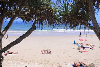
Byron Bay is the most easterly point of mainland Australia, boasting beautiful beaches, a hive activity with surf lessons, kayak adventure tours, seaside resorts and quaint cafe's & shopping.It seems to be on every tourists east coast itinerary, so we were interested to see what all the hype was about.

It was a beautiful summers day and as we pulled into the township there was already a hive of activity!People walking down to the beach for their morning swim or off to a late breakfast at one of the many cafe's. We decided to slip in with the crowd and enjoyed a coffee near the beach. We wandered around the shops for a while before making our way to the Beach. It was gorgeous! turquoise blue water, perfect waves for body surfing and not over crowded... yet. Although we got a little too burnt, it was a lovely day spent exploring the coast line around Byron. Later that evening we stayed with Anneke and caught up after not seeing each other for about 7 years!


(Beautiful Beaches at Byron Bay.)

The following morning we set off for Coffs Harbour, home of the BIG BANANA! Its quite a large place of 70,000 people. We spent the weekend there exploring the beaches and local markets. The marina was also a great place to hang out and soak up the towns atmosphere.


When Monday morning came around we headed off south to explore more of the coast line. Calling into Nambucca Heads which offered great views of the beaches and local river system. We pushed on to Arakoon, to visit Trial Bay Gaol. It looks quite dramatic perched on the headland to the bay. In 1886 it was the only jail built especially for public works. Prisoners were to construct a break wall to create a safe harbour for passing boats. However the project was abandoned by 1915 as the the large surf continued to destroy any progress made. It was really interesting to walk around and i must admit a little Erie at times. Before moving on we took a refreshing swim in the bay...


(Enjoying the view at Nambucca Heads.)


(Inside the Trial Bay Goal)


Not far from Arakoon is Hat Head National Park. A beautiful stretch of coastline, with rugged cliffs, pristine beaches, just the perfect mix for camping! After visiting the Light House and admiring the views, we set up camp. The following morning we went for a walk along some of the grassy headlands. It was beautiful and the local kangaroos thought so too!!

(The view from the Lighthouse, Hat Head National Park.)


For Christmas we had received a day out with a fishing Charter out of Port Macquarie. So this was our next stop along the coast. We had to spend a few days there, as with the summer holidays most spots were already filled. We didn't mind, it gave us a chance to tidy up the car and check out the town and beaches. Finally the morning arrived where we went on the fishing charter. We had to be on board Ocean Star at 5:30am!! So it was a very early rise as we had to pack up camp before we went!! There were about 11 on the charter and the day was perfect. We mainly set out fishing for Pearl Perch, Snapper and flat head. We were only about 5 mile off shore and amazingly fishing in 50 to 70 metres of water!! It was very different to fishing up in the kimberley's that's for sure!! Over the next few hours we brought up various species, red rock cod (thrown back), snapper, sweep (thrown back) & Pearl Perch. Although it was all very exciting nothing of real size was pulled over the sides, The biggest fish for the day wouldn't have been much over 35cm! We arrived back from the fishing charter around midday, even though the quality of fish wasn't what we were expecting, it was an awesome day out and we still managed to take home a feed of fish for dinner!

The coast line South of Port Macquarie is very unique with a number of lakes so close to the coast line. We explored a few of these before calling into Crowdy Bay National Park for a swim! We were considering stopping here for the night however it was VERY POPULAR!!! We decided to try further down... We continued on through Forster, a beautiful spot that again boasts both lake and ocean access. I wanted to pull into every lookout, the colours were amazing and the water so clear!


(Diamond Head, Crowdy Bay National Park.)


(Views of the coast line near Forster.)


Near to Forster is Myall Lakes National Park which were were very keen to explore. However upon arrival we noticed that camp spots were very scarce and the information provided by DEC wasn't all that helpful. Today just wasn't working out to be our day... So after a quick look around we headed out and pushed on to find a place to stop the night. Finally stopping in at the quiet town of Karuah in the far reaches of Port Stevens.

We had an amazing time travelling down the North Coast, and were really spoilt for choices when it came to choosing which beach to swim at or which towns to spend some time in. Next stop... a quick trip into the Hunter Valley & into Sydney!!

Friday, December 18, 2009

- Round Trip to Brisbane -

Our plan, all along was to reach Brissie in time to fly to Victoria for Christmas, however we had arrived a couple of weeks early and decided to do a trip inland to make the most of our time.


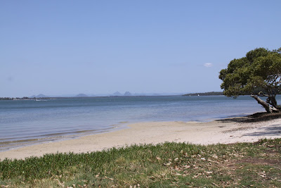
(On Bribie Island looking over to the Glass House Mountains.)


We spent the next morning over on Bribie Island, checking out the beaches & coffee shops overlooking the water. It was a perfect spot to spend the morning. We turned the car around and headed for the hills calling past Kilcoy for fuel and spending lunch on the banks of Somerset Dam. The one thing that always surprises me while travelling is the ever changing countryside. The area around Kilcoy is very dry and the Lake seemed to be extremely low and the constant reminder of water restrictions was present on every town we passed through.


(Relaxing after lunch at Somerset Dam, near Kilcoy.)


We spent a few days hanging out in the quiet country town of Nanango, before heading up to the Peanut growing town of Kingaroy. Kingaroy is quite a big town and the lookout was a perfect place to get a greater view of the surrounding country. We could see all the way to the famous Bunya Mountains... our next destination!


(Kingaroy's Peanut Van, sells fresh local flavoured peanuts....)


In a section of the Great Dividing Range, The Bunya Mountains is home to the Worlds largest forest of Bunya Pines. With an elevation over 1100m above sea level is some areas, the view proved to be magnificent. We took several walks through out the area and were ever cautious of where to park the car as the Bunya Pine grows unique pine cones which can grow to over 10kg!! It was an awesome spot and would be a perfect holiday destination in the winter months with log cabins and B&B's scattered along the edge of the national park.

(The mighty Bunya Pines...)

(A view from one of our walks in the Bunya Mountains.)


(A great action shot of one of the mountain locals.)

We continued down the other side of the range and headed out to visit Muntapa Tunnel. A abandoned railway tunnel, QLD's longest of 287m,which is now home to a colony of Bent Winged Bat's. It was quite interesting to read about the tunnels history with its construction back in 1912 it remained open until 1964. We then took the Erie walk through the full length of the tunnel... it wasn't all that pleasant with the smell of the bats.. to make matters worse i accidentally startled them while taking a picture and we had to quickly get out! Bren wasn't impressed! We returned to Cooyar, enjoying a beer at the local pub before setting up camp.


(The bat's flying out of the tunnel after i accidentally startled them.)

(Bren is unsure he wants to continue...)

(The Cooyar Hotel...)


The following morning we drove the remainder of the way into Toowoombah. Toowoombah is Australia's largest inland - regional city and is perched on the edge of the Great Dividing Range. We spent several hours exploring the city, with its beautiful ornate gardens, spectacular lookouts. We also took a look around the Cobb & Co Museum, home to the National collection of horse-drawn vehicles. The collection was quite amazing with everything in pristine condition and offered a great insight to the past.


(An old Cobb & Co mail carriage.)

That afternoon we drove back towards the coast, pulling into Wivenhoe Dam for the evening. It was a nice shady spot and there were plenty of kangaroos scattered along the banks of the lake. Even better as we practically had it all to ourselves.

(The view from our camp at Lake Wivenhoe.)


The next morning we pushed on through Ipswich and into the hustle & bustle of Brisbane. It was crazy being amongst the city traffic after a week out bush! But eventually we found our way and a place to base ourselves just south of the city.

Brisbane is known as the "River City" with the city built lining the banks of the Brisbane River. We caught a river ferry cat into the city and took in the sights including the botanical gardens.
We spent the remainder of the week exploring the city and surrounds before flying out to Melbourne for Christmas.

(Approaching the Story Bridge, on the Brisbane River City Cat.)


Sunday, November 29, 2009

- Teewah Beach -

Straight after arriving back on the Mainland from Fraser Island we drove through the township, Rainbow Beach onto Teewah Beach which is South of the town. It's apart of the Cooloola National Park and offers safe swimming beach, great surfing and over 15km of coastline to set up camp.

(Teewah Beach, view from Double Island Point.)

We drove onto the beach and headed for Double Island point to check out the views from the lighthouse. It was a very popular spot with an awesome surf break and sheltered swimming. the views from the Lighthouse were spectacular!


From here we headed south down the beach to look for a camp.. which being a 15km "camping zone" we thought we'd find a camp without too much trouble.... How wrong we were! Being a Friday... it was packed... tents, tarps, 4wd's, camper trailers, kids, surfers, beach cricket, fisherman all seemed to be stretched out all along the beach. We were beginning to wonder if we'd find a semi secluded spot at all!

(Campers were squeezing in to get their peice of paradise.)

Eventually we did find our spot... and in our minds a bloody beauty! although a little close to some others, we had unlimited views of the beach and only had to walk 20 metres to the waters edge.

(Our camp for one night.)

It was a magical spot, although i'd definately consider next time what time to visit.


(I got up early to capture this lovely sunrise.)

Friday, November 27, 2009

- Fraser Island Adventure -

Heritage listed Fraser Island is just off the coast of Hervey Bay, it is the world largest sand island. Stretching 123km in length and only 22kms wide, this unique part of Australia lures adventure travellers to its shores.

With its long interrupted beaches, pockets of rainforest, over 100 freshwater lakes and the abundance of wildlife it is the perfect recipe for a fun filled 4wd camping trip.

After much planning and research we decided to take the car over for a 4 day adventure. We first had to get there, which meant booking the car on a vehicle ferry to cross the Great Sandy Strait. A 50 min ferry ride later we drove off the ferry and onto the island, passing through Kingfisher Bay Resort before reaching the start of many 4wd sand tracks. From the numerous self drive travellers and tourist coaches the track was quite cut up and soft in sections, so we had to let down our tyres a few times to make it much easier to drive.


(The vehicle barge to Fraser Island)

( 4wd Sand tracks are the only roads on the island)

Along the western side of the island there isn’t a great deal to see, so we headed inland passing by a couple of freshwater lakes and sand blows before reaching the eastern coast. This uninterrupted beach is a gazetted road, being the easiest & quickest way to reach the top tourist sites it can be more like a highway at times!

( 75 Mile Beach was more like a highway at low tide.)

(Sand blows were spectacular, some have engulfed entire lakes and forests.)


On our way to find our first camp for the night we came across the ship wreck of the Maheno. In 1935 the Maheno was being towed to a Japanese wrecking yard when she met her stormy end in a cyclone just off the coast. It was pretty awesome to see with the waves lapping against its rusty hull, providing an excellent opportunity for photos! We pushed on further north along the beach to find a perfect campsite complete with ocean views and a grassy spot to put up our tent! With a few wines and the sound of the waves, it could get any better than this... or could it??


(The Maheno shipwreck.)

(What an awesome camp spot, 1st night on Fraser.)


The next morning we woke to rain! Making it a very interesting while packing up! However in no time at all, the weather cleared and we were back into exploring the island. First we called by the pinnacles, a section of weathered dunes of contrasting coloured sands. Then called into Happy Valley for a look, it’s a tourist village offering an alternative accommodation to camping.


(Coloured Sands.)


Our next stop though was Eli Creek. It’s a freshwater creek flowing across the beach into the ocean with boardwalks along its upper reaches into the dunes. Here was also the place of our first sighting of a Dingo, who was just going about its business paying no attention to us at all. Eli Creek is also a popular spot to swim, as it is advised against to swim in the ocean, with rough seas and the occasional croc sighting.


(Eli Creek, great spot to explore.)


From here we headed inland, winding our way up into the rainforest and sand dunes to visit Lake Wabby. Lake Wabby is known as a Barrage Lake which means it has formed when a sand blow blocks the path of a natural spring. Eventually the sand dune will engulf the lake, making us feel very fortunate to visit while we still can! It was steep walk to get to the waters edge, however worth the effort as we plunged into its cool calm waters! When we finally got back to the car we slowly made our way back to the beach, getting stuck in the soft sand a few times on the track. We decided to drive further south to find a suitable campsite where we could make our base for the next few nights.

(Looking down to Lake Wabby.)

Just south of Eurong (Another resort village) we found the perfect spot. Nestle behind a small sand dune, with plenty of trees for shade we made our camp, putting up a few extra traps in case the rain set in again over night.

The following morning while getting ready for our next adventure 2 Dingo’s casually strolled past our camp. They’re believed to be the purest strain of Dingo and have become well accustomed to the presence of humans on the island. Everywhere we went there were warnings about Dingo’s, mostly not to approach and to make sure food etc is securely stored. One camp we saw looked like it had been torn apart by Dingo’s as there was rubbish everywhere.


After refuelling at Eurong we set off inland again to visit the most popular lake on the Island, Lake McKenzie. We’d have to say this is one of the BEST beaches in the world. It was amazing, pure white sand giving way to the crystal clear water… certainly an unusual paradise! The lake is a ‘perched’ lake which means it is only rainwater, no ground water or streams feed into this lake. The natural composition of sand and organic materials at the base of the lake, form a special layer preventing the water from draining away. We spent several hours swimming, lounging on the shores it was beautiful, however the crowds were starting to arrive so we decided to push on.

(Beautiful Lake McKenzie)


The drive from Lake McKenzie continued onto Central Station, which was once a logging community, however now home to National Parks Info Station. From here the track continued to wind its way through sand dunes, rainforests, and bushland. We stopped off at Lake Birrabeen and Lake Boomajin before reaching the eastern Beach again just south of Eurong.

The following day we spent relaxing in our camp, reading, walking along the beach and enjoying the fact we didn’t have to drive anywhere. The next day we packed up early and drove to the most southern point on the island, Hook Point. Here we caught the ferry to Inskip point on the Mainland.

We had the most amazing time on Fraser Island and would definitely go back to visit again. Not only is it a camping and 4wd adventure, it offers a unique beauty which you cannot find anywhere else. Let’s hope it stays that way for many years to come.


(The Barge to Inskip Point took only 5mins to reach the mainland.)


(CLICK TO ENLARGE MAP)