

After picking up some last minute supplies, we left Cooktown via Battle Camp Rd. Battle Camp Rd is known to be rough and can be completely impassable during & after the Wet. We soon got a taste of what was on the horizon, with the amount of corrugations, bull dust and the flooded creek crossings we encountered along the way. This is part and parcel of “doing” the Cape and we loved every minute of it!
 (Roadtrain throwing up the dust on the way up Cape York.)
The next morning we explored more of the National Park almost reached the ocean in search of a decent high bank to fish off. After getting some advice from a couple of fellas we met on the road, we tried our luck in a favourable waterhole for just over an hour. After a couple of teasing splashes, we soon realised today wasn’t going to be our day. We were soon back on the main road heading north 170km of dusty, spine tingling corrugations, we eventually pulled into camp at Archer River Roadhouse and the luxury of a hot shower!
 (Old Laura Homested, Lakefield NP.)
Just after first light we were back on the road again navigating our way out to Iron Range NP, via the Aboriginal Community of Lockhart River. The road was in good condition after recent road works making the journey relatively smooth. We made an early camp so we didn’t miss out at very popular Chilli Beach! It was blowing a gale, but that didn’t hamper our spirits, after setting the awning and an extra tarp as a wind break we soaked up the sun over a good book. We were sitting on the palm tree lined beach, sounds of the ocean and the view of islands scattered across the horizon, what more could we ask for?
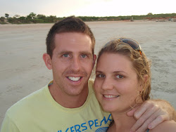
 (Bren, soaking up the sun... what a place!)
 (Our camp/windbreak, Chilli Beach.)
 (Palm trees @ sunrise, Chilli Beach, meters from our campsite.)
From Chilli Beach we could return to the main rd, via the way we came or by taking a 50km “shortcut” via the Frenchman’s Track, saving us about 90km of back tracking. The Frenchman’s Track can be quite challenging as it is not maintained, nor is it sign posted and depending on the time of year can be totally impassable! The major hurdle would be the Pasco River crossing, we learnt this from our handy guide book, it reads “caution deep river crossing, should only attempted by experienced 4x4 drivers only”. The crossing was only 16km in from the turn off so we decided we’d drive in to check it out and see if it was within our experience to make the crossing.
We made our way in over a fairly reasonable track, a few washouts, patches of the usual corrugations and ruts. Eventually we reached the Pasco River, we jumped out to investigate by wading across the river (about 0.6metres deep) to check out the steep & rocky embankment on the other side. After assessing the conditions we decided to go ahead as this would be our only major 4wd adventure while up the cape & not wanting to hammer the car as we still had a long way to go! We crossed the river successfully dodging a large boulder without a problem, then put the car into Low range and slowly navigated our way up the rocky slope! It was exciting, wheels spinning, and redirecting the wheels a couple of times saw us comfortably to the top no worries!
 (The climb after the crossing.)
 (Pasco River Crossing.)
 (Looking back down the hill.)
 (Bren, after the Pasco River Crossing.)
The track continued with deep washouts, ruts and creek crossings keeping our speed around 30 kph! One crossing in particular was a little deceiving with the first section slightly deeper and the water pushed over the bulbar for a few seconds before levelling out into shallower water. Thankfully no water came in under the doors! After crossing the almost dry Wenlock River we finally reached the main road! What an adventure, 50kms worth and it took us about 3 hours! We then pushed on to camp at the Jardine River ready to cross by the river ferry first thing in the morning…
TO BE CONTINUED>>>>>>

(Wenlock River, Note the sign... "we were here in a boat...")

No comments:
Post a Comment