

We began the day early, purchasing our ticket for the ferry across the Jardine River, which is fairly expensive, however does include some bush camping, access to communities and the maintenance costs for the camp grounds. Due to the time of year the crossing wasn’t all that impressive, looking rather shallow and the ride was over in a matter of seconds. So before we knew it, we were back onto the bumpy corrugated roads on our way to Bamaga (which is the main community on the cape).

(The Jardine River Ferry)
At Bamaga we refuelled and decided to head out in search for a number of WWII plane wreck sites that were marked on our map. It was quite a surreal adventure as there weren’t any signposts. We just had to find our way by following a small track and bashing through the bush over logs etc. Gradually the track opened up into clearings strewn with old rusted aviation fuel drums, and then eventually we arrived at the plane wreck. I later read that this one was a Beaufort Bomber which came down not far from the old Jacky Jacky Airstrip. We also visited the crash site of a DC3, which had come down on its way from Brisbane to New Guinea in May 1945.

(The Beaufort Bomber WWII crash site.)
 (DC3 remains from at flight enroute to New Guinea.)
On returning to Bamaga we took the road north out of town and made the 34km journey to the most northern tip of mainland Australia. The track was considerably winding and cut through a large pocket of Rainforest for most of the way. This surprised me as I expected the tip be quite barren and rocky, not with lush towering trees and lush vegetation! We finally made it to Frangipani Beach, parked up the car and went looking for the track to the tip. Thankfully a recent traveller had made a makeshift sign showing us the way!

(Makeshift sign to Direct travellers...)
We followed a rocky ridge heading towards the ocean. It wasn’t the clearest of days and we began watching a rolling cloud come in as we walked. It wasn’t until we made it to a lookout plaque before the rain came hurtling down on us!! Looking back it must’ve been quite funny watching us trying to shield our cameras from the rain under our shirts! The rain passed as quickly as it had arrived and we continued down to the waters edge to the sign declaring we had made it to the most northern point of the continent!


(Above 3 Pictures: At the most northern point of mainland Australia!)

Back at the car we drove back through ‘Pajinka’ which was once an Aboriginal Owned Wilderness Lodge. Now the buildings are just a shell and a lot of rubbish has been left behind. I’m sure there is more to the story since its closure in 2002; however it was a real shame to see this popular tourist destination still looking like a dump nearly 8 years on! Certainly somewhere the hefty Jardine River Ferry ticket money would be put to good use!
On the return track from the tip we passed so many travellers it was hard to believe we were far from civilization! We explored a number of camp grounds on the way back, however decided on staying in the seaside township of Seisia with the convenience of catching the Ferry to Thursday Island the following day! The remainder of the day we spent catching up on the laundry and reorganising the car.
Shortly after 8am the next morning we boarded “Straight Magic” for our 1 ¼ hr ferry ride to Thursday Island or T.I as it’s also affectionately known. It was an informative journey with the skipper pointing out the numerous islands and their historical significance. We passed Possession Island where Captain Cook first claimed British sovereignty over the eastern part of Australia in 1770 and islands of local pearling history as we rode the waves into the Port of T.I. Once on land, most of passengers decided to join the local tour, however we decided to explore around the island by ourselves. Walking down the main street you could swear you back on the mainland in some small outback town, however walking into the shops we were swept away into island life and the diversity of influences from nearby Papa New Guinea and surrounding islands of the Torres Strait. One shop in particular was filled with bright Hawaiian style printed cloth and clothing, worn mostly for festivals, special occasions etc.

After locating a town map, we headed up the steep Green Hill to visit the fort. It was built in 1890 and used as a defence centre for Australia, watching with 4 loaded canons over the nearby shipping channel and again in WWII keeping watch for invasions by the Japanese. It now houses the historical society museum of the Island, which we soon learnt that we had to go on the tour to have access to it!! Bugger! However the effort walk up the hill wasn’t all lost, as from here we got a spectacular view of T.I and surrounding islands.


(Awesome views from Green Hill, Thursday Island)
We continued on visiting significant buildings & places of the township and back through the shops for another browse. For lunch we headed to the Grand Hotel over looking the water, it was magic! We spent the rest of the day relaxing on the foreshore and watching island life. If we had more time we would’ve taken a tour over to neighbouring Horn Island where they offer insight into life during WWII and exploring the remnants of war bunkers and aircraft crash sites etc. However before we knew it we were back on the boat heading for the mainland. What a glorious day spent on T.I!
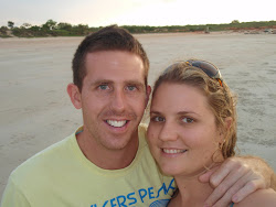
 (Sunset back on Seisia Beach)
No comments:
Post a Comment